


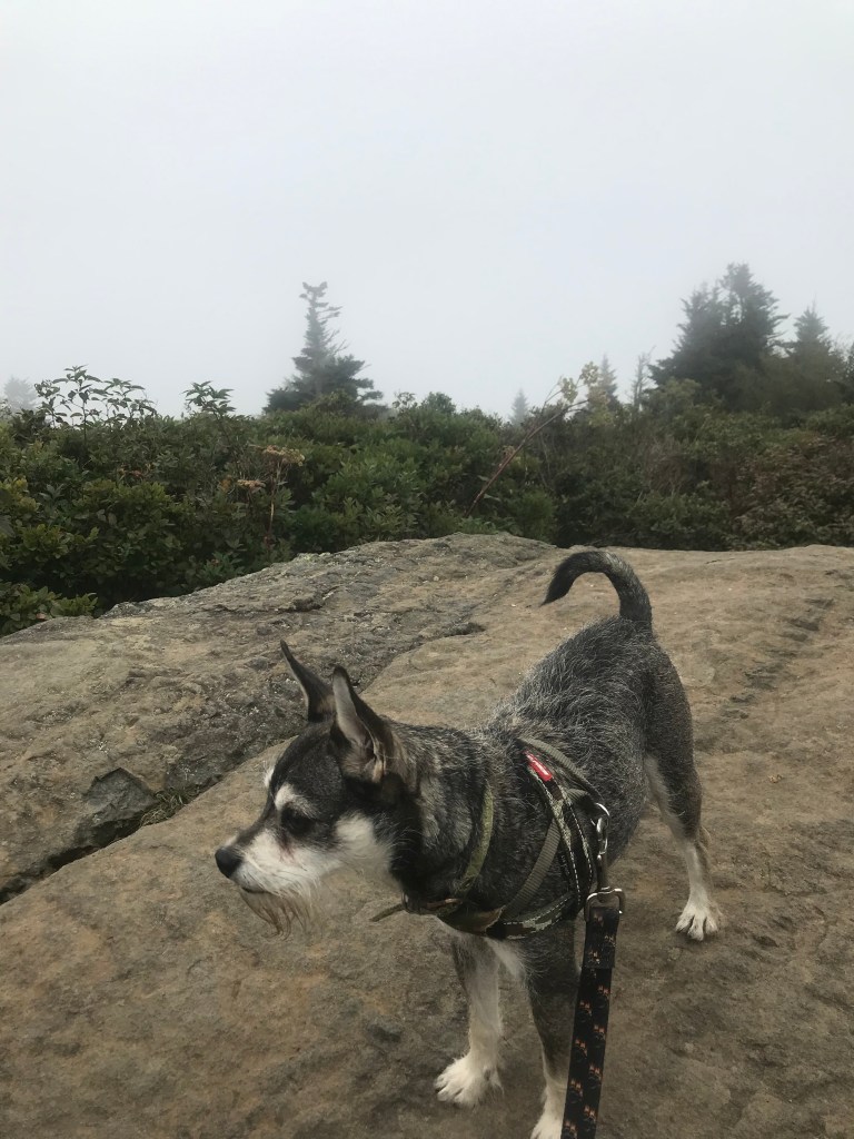


Let me just preface this by saying it has been way too long since I have ventured out on a trail. I have had a very busy summer with my new project and all, but I realized today, that there is nothing like a hike to help level everything else going on in my life out. My last hike back in May did not go so well, this one? It was fantastic! I have had this hike on my list for a while and it turns out it was a perfect hike for a return to the trails. It was also my first solo hike in a while. Only I wasn’t really alone…my bestie, Maximus accompanied me. He was quite popular with the other hikers we encountered.
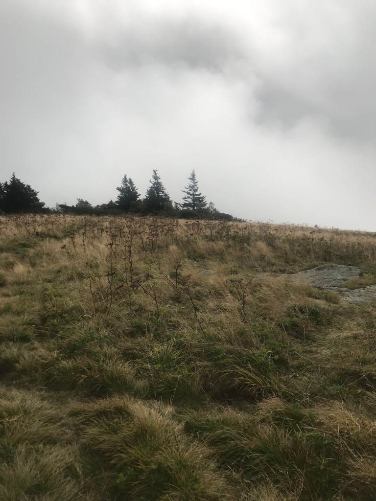
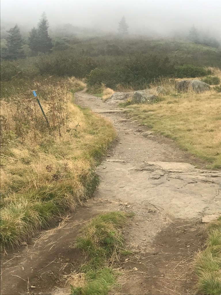
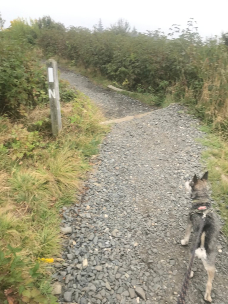
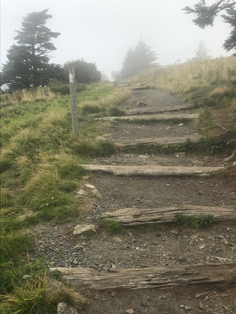
Maximus and I rolled out around 8:30 and headed to Roan Mountain, about a 2 hour drive from our house. We stopped a couple of times and arrived at Carver’s Gap around 10:00 am. As we climbed Roan Mountain in the Jeep, the sky around us was clear and blue, the sun shining and the day promising to be a very pleasant day; however Roan Mountain was enshrouded in cloud cover and as we climbed the temperature dropped into the low 60’s. Carver’s Gap at 5512ft elevation was cloud covered and the air had a bit of a chilly bite to it. Maximus and I got our backpack out and headed across the road to step onto the Appalachian Trail. We began a slight, winding climb towards the first of the three Balds. The Roan Mountain Highlands are a popular day hiking destination and we met lots of other folks out and about enjoying the trail as we were. The clouds sitting atop the mountain gave us moments where we felt isolated and the rolling misty fog was enchanting. Views were limited to immediate surroundings and that was OK. It just felt good to be on the trail.
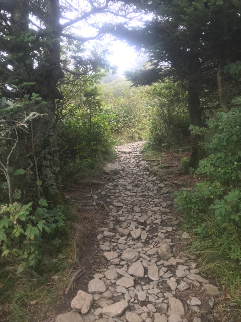
There is something about the Appalachian Trail that calls to me every time I venture out on it and this time was no exception. I tell myself that someday, someday I will walk its full length. The fact that it passes so close by gives me ample opportunity to enjoy many short section hikes. The iconic white blaze never fails to make me smile. We crossed Round Bald and headed down to a slight gap before climbing to Jane’s Bald at 5807ft elevation. Elevation gain is cumulative on a hike, so ups and downs add to the elevation gain for the hike itself. According to my Apple Watch, our total elevation gain for the hike was 1143ft total. Not bad for 5 1/2 miles, our total distance for the day. The trail has some fairly steep, rocky places so my hiking stick came in handy several times. Maximus had no problems. He was quite the attention hound too, a very friendly pooch, he was well received whenever we met other hikers.
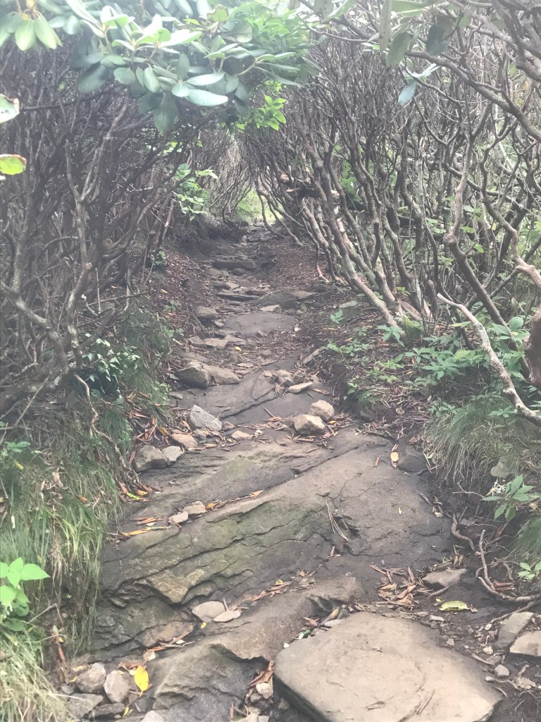
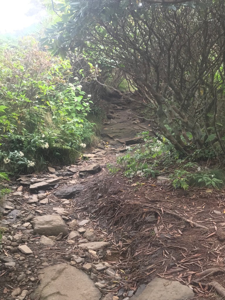
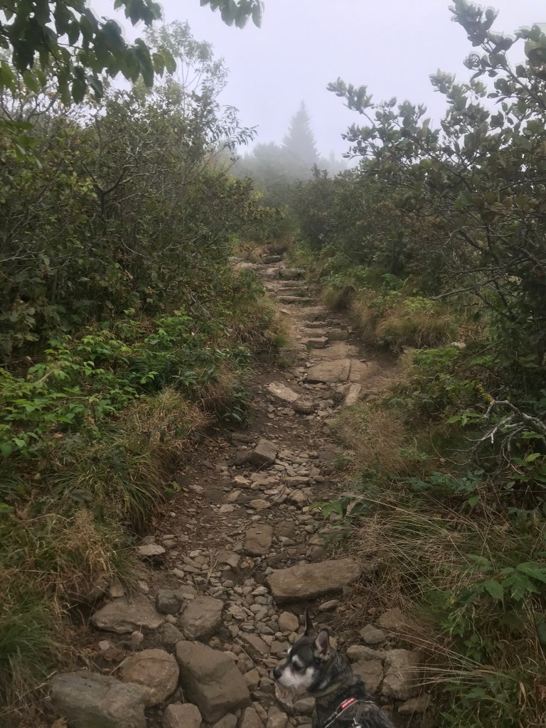
At Jane Bald a nice pair of ladies got some pictures for us and we returned the favor. Hikers in general are super people. The mist seemed to be lightening as we hiked on and the hours passed. We met a quartet of section hikers from Iowa and chatted with them a little about their experiences on the trail. The sun broke through the cloud cover in places and the hike back out promised to be a different hike. The AT makes a nice sharp left turn, to get to Grassy Ridge, one just continues forward. There is a blue trail marker indicating that one is leaving the AT for a side trail. We immediately began a narrow, rocky climb up what was almost a rock filled gully between very thick vegetation. We had to step up out of the trail bed to allow other hikers to pass us going in the opposite direction. This did not bother Maximus as he got petted almost every time.
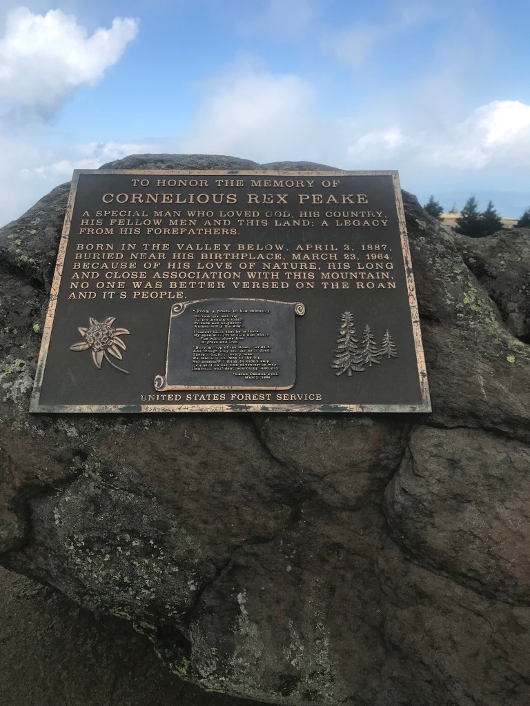
When we stepped out of the thick vegetation onto the 3rd of the 3 Balds it was breathtaking. The fields stretched out to either side of the path, the cloud cover creating an enchanting world. We hiked, still climbing a bit. We passed a campsite and spoke to the campers and we followed the well defined trail to some huge boulders. We were told by a nice couple hanging out on the bald that these stones were the heart of Grassy Ridge. There was a plaque on the boulders dedicated to Cornelious Rex Peake. Maximus and I stopped here for some refreshment before heading back down the trail.
The cloud cover thinned significantly and the world opened up around us. The AT follows along the Tennessee, North Carolina Border so if you look off one side of the trail you are looking into Tennessee; North Carolina stretches off into the distance on the other side of the trail. There are places where a body can see for miles and miles. Max and I stopped a few times to just gape at the mountains rolling away from us and at the tiny little signs of civilization off in the distance. Our hike took us 3 hours and 45 minutes, the distance not so much as the sight seeing and letting Maximus get his well deserved attention, contributed to our time line. This was a very comfortable hike, the cool mountain air refreshing and invigorating.
