


On Saturday February 6, 2021, I set out to meet my sis for our first hiking adventure of 2021. Donna and I discussed which trail to do for the day and finally decided on a trail in the Cataloochee area of the Great Smokey Mountains National Park. I met my sis after I pulled off of I-40 on the Maggie Valley exit in North Carolina. She lives not far from the exit. She had decided on a trail that neither of us had completed and we headed over the winding mountain road towards Cataloochee.
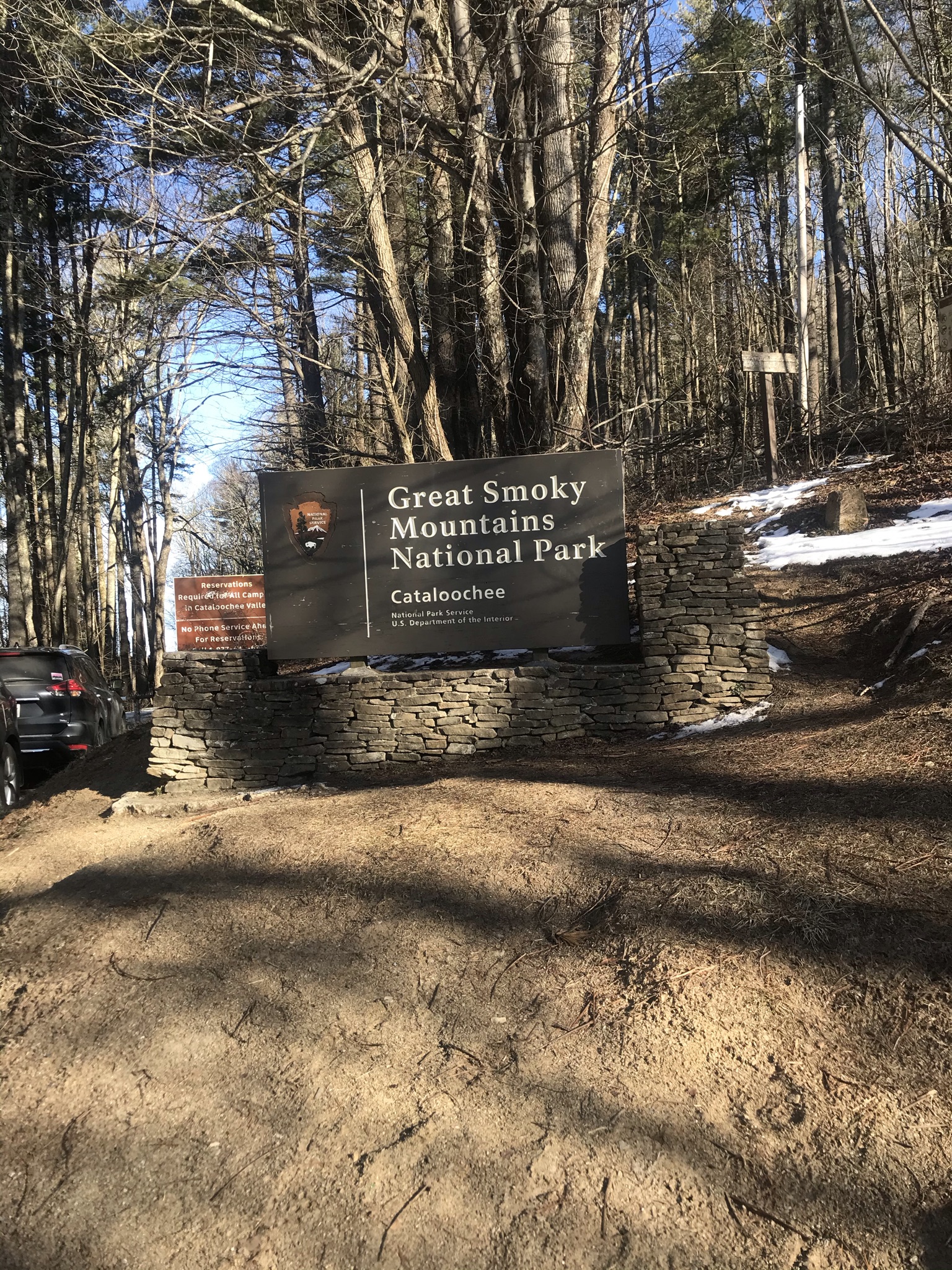
We drove up the mountain to run into a closed gate next to the Great Smokey Mountains National Park Sign. Apparently the conditions on the road leading into the beautiful little valley were treacherous enough for the Park to close it to traffic. We pulled up and started to turn around and I mentioned that I had not completed the Cataloochee Divide Trail. I had previously hiked the section of the trail between McKee Branch and Hemphill Bald a couple of different times on different exploratory and loop hikes in the area, but the 4.6 miles from the trail head at the road to McKee Branch were still on my to do list. Donna had already done this trail with others but she shrugged and said “Why not?” We were at the trail head and the day was getting away from us. The weather promised a nice little wintry brew later that evening and we were comfortable we could knock out the 9.2 miles in and out in plenty of time to make it off the mountain and for me to get back to Tennessee before it got really nasty.
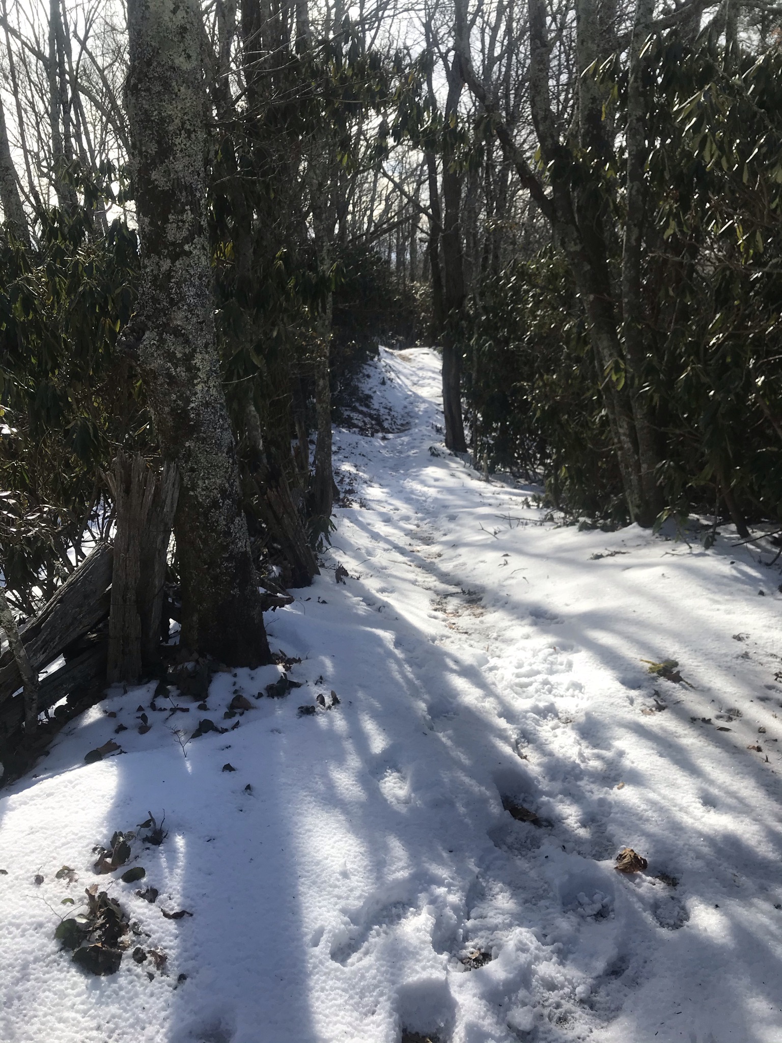
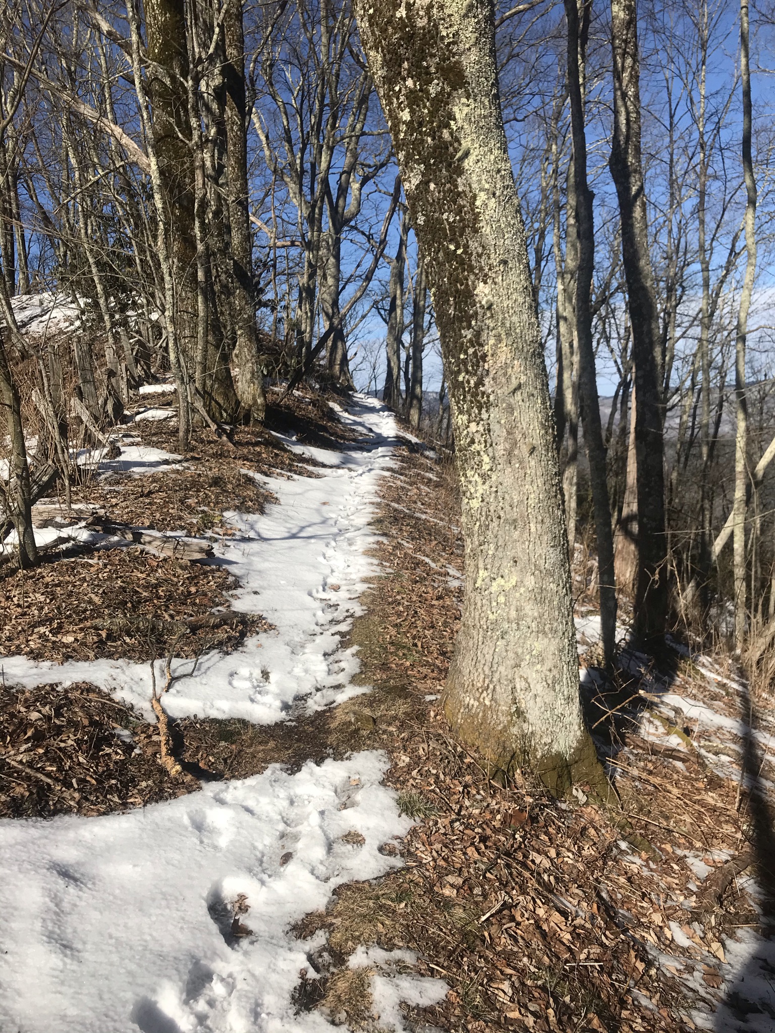
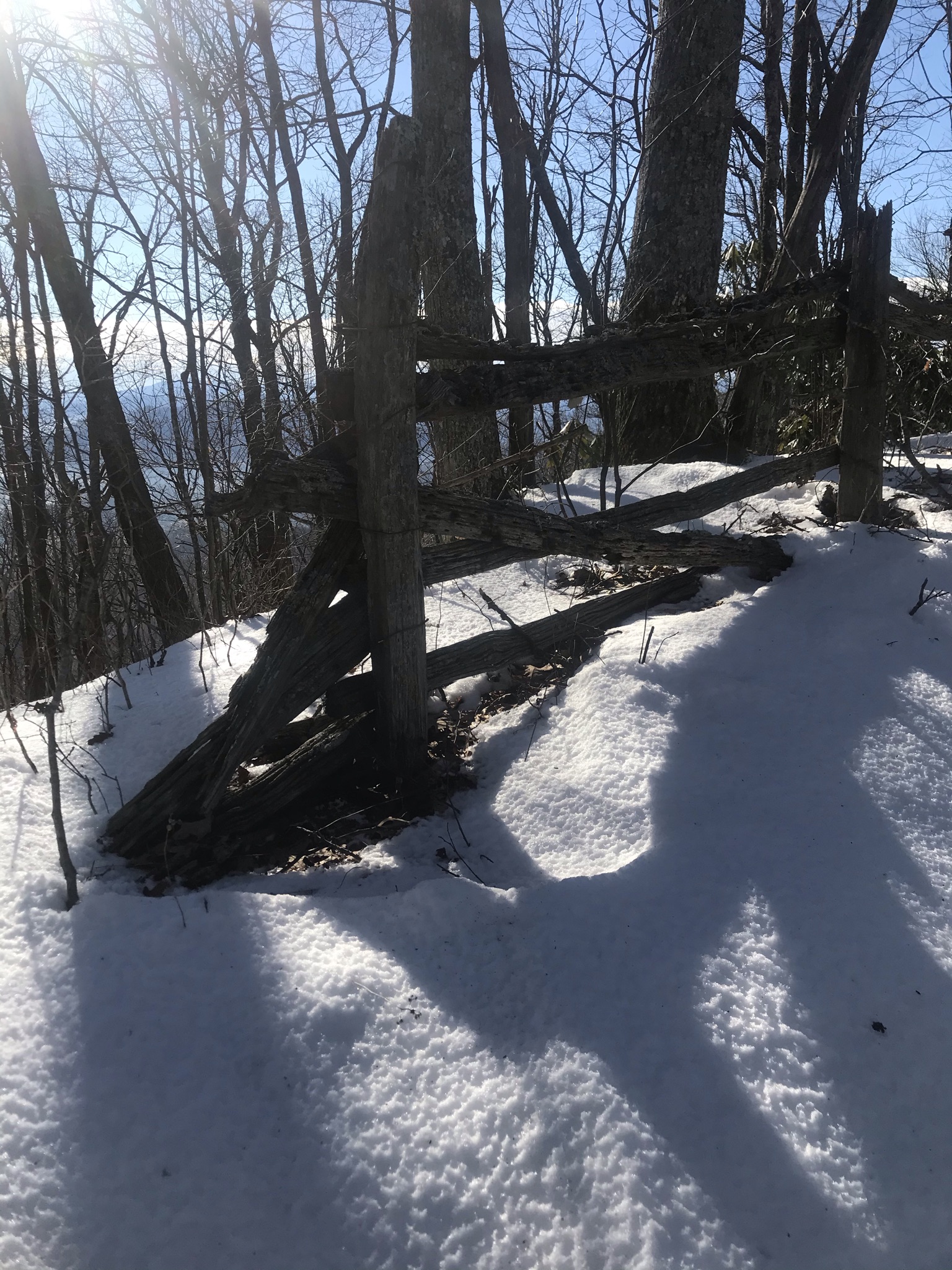
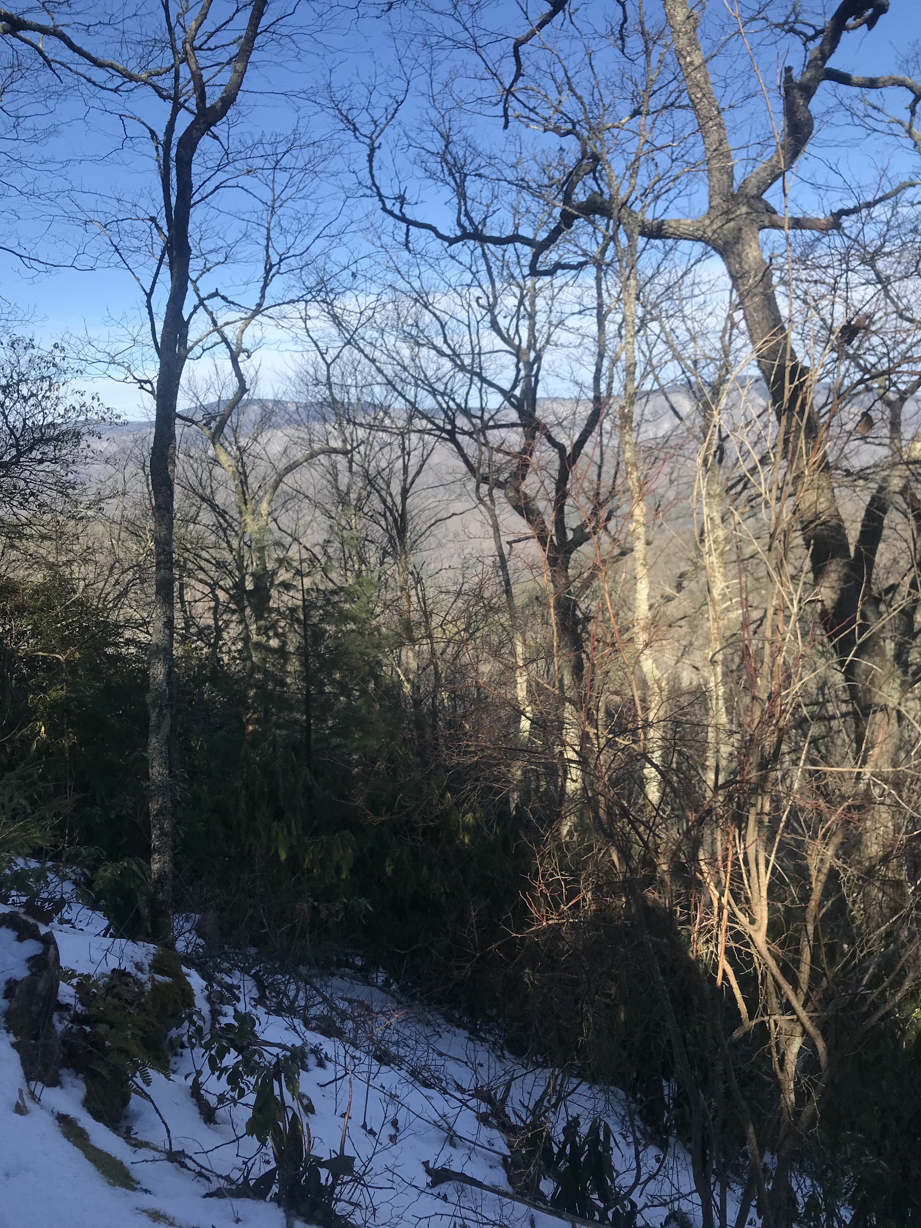
The Trail runs along the Park Boundary with the trail head located on NC highway 264 at Cove Creek Gap. If you hike at all, you know that if you are in a Gap the only way out of the Gap is up, an so we began a decent little ascent, 500 ft of elevation gain before leveling out somewhat. The snow that was already on the ground made the hike a wee bit more challenging. The Snow cover was patchy, in some places it was a light dusting if there at all, in others it got a bit deep. The sun was out and shining brightly as we began our hike and the promise of a storm seemed far fetched. The trail has really neat views. On one side the mountains of the National Park stretch out in the distance, on the other side of the ridge civilization marks the terrain. There are nice rental cabins along side the trail and the remnants of a wooden fence made for some neat photos.
Donna had hiked the trail in the summer and she said she was glad we did it now as its personality was different reflecting the season. The lack of foliage allows a body to see farther. The lack of undergrowth shows the terrain. It has been my experience that every time I hike the same trail, it is never the same trail. Some landmarks dominate the trail and define it, but the little things are constantly in flux and the eyes are drawn to different details. The weather also changes the experience of the trail. Hiking one in the rain, the heat of summer, the chill of fall with the changing leaves, and then in winter leaves different impressions on the soul.
Our hike started out in chilly sunshine, my layers perfect to keep me from getting too hot or chilled. The trail is a nice little ridge line walk once you climb out of the Gap. The Ups and Downs keeping it interesting. The drifts of snow made for fun passages. Footprints marked the passing of previous hikers. As we got some distance down and time passed, dark clouds began moving in and the promise of the coming storm looked more real. White cumulus clouds gave way to grey clouds and after a while the entire sky turned grey and the sun went away. The chill in the air became more evident as the sun hid. Climbing, I was never chilly, going down hill, and when we stopped to snack I could tell the temperature was dropping. I must say, I really appreciate the Merino Wool base layer.
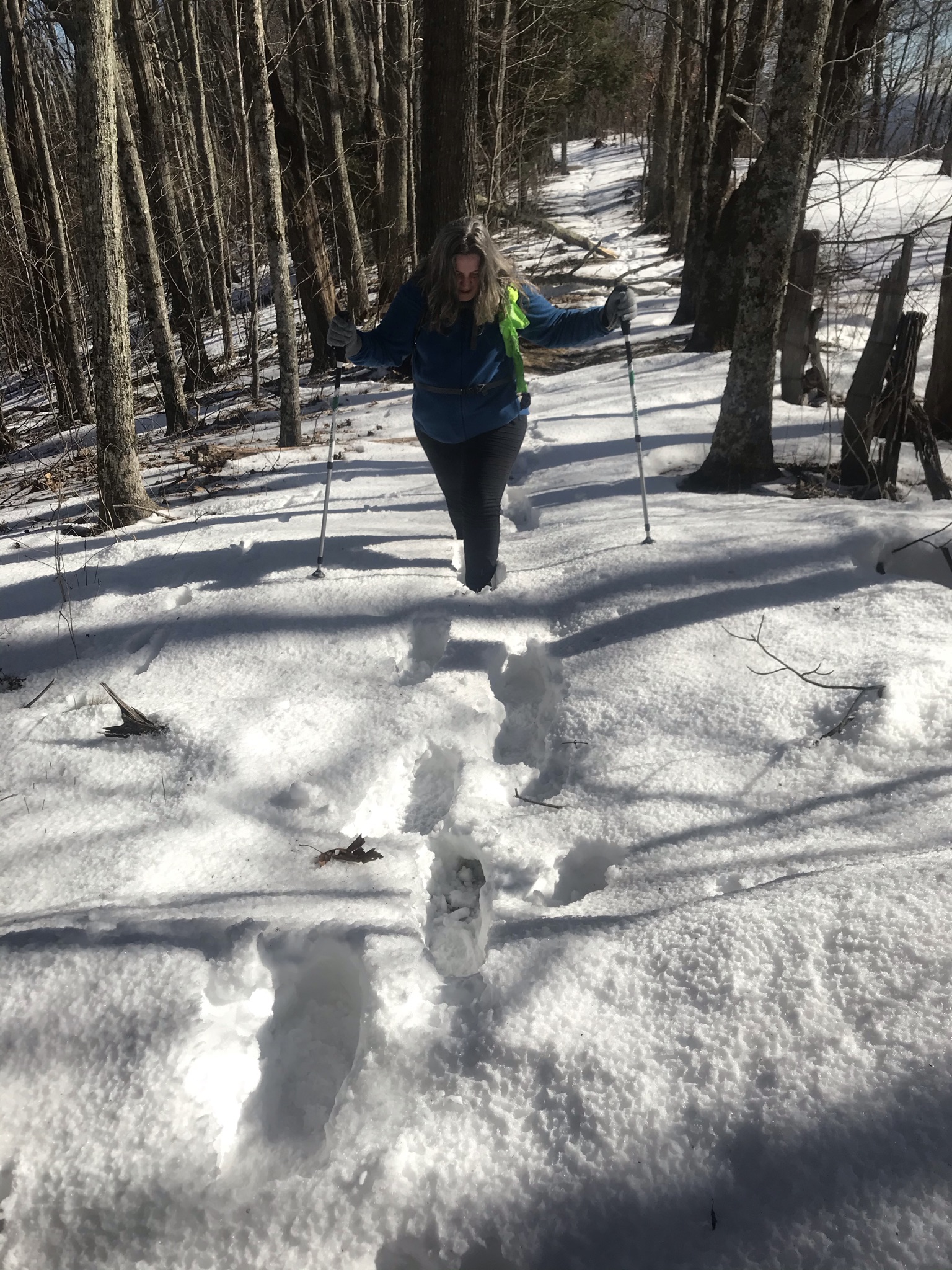
The toughest part of the hike was the last push towards the Mckee Branch trail intersection. The elevation gain here was a little over 800 ft and we ran into a very slick, icy patch of snow creating hazardous footing that slowed us down a bit. We passed a group of hikers returning from the Swag, a popular spot on the Cataloochee Divide Trail. We were not going quite that far. By the time we made it to the trail junction the skies had darkened enough to make us have second thoughts about being 4.6 miles from the Jeep.
We made the junction and turned for the return trip. Going downhill over the icy snow was a challenge and we talked about getting some spikes to use for hikes like this one. When we stopped for a bit of a snack, it started to snow flurry. Donna checked her phone, which had limited service, for a storm tracker she uses and it said the front was still a ways out but moving in. The snow flurries increased and we hustled down the trail intent on making it off the Mountain before it got too bad.
We passed a couple of hikers on our way out, which surprised us with the incoming weather. We spoke and wished them happy hiking as we pushed towards the trail head. Happily, we made it and the weather predictions were more correct than our worries. I made it over the Mountain and back to Tennessee without weather incidents. Sitting here in the humid heat of June, looking at the snowy terrain, I am a bit wistful for a chilly breeze. Until next time.
